
Cross Lake
Burnett County, Wisconsin
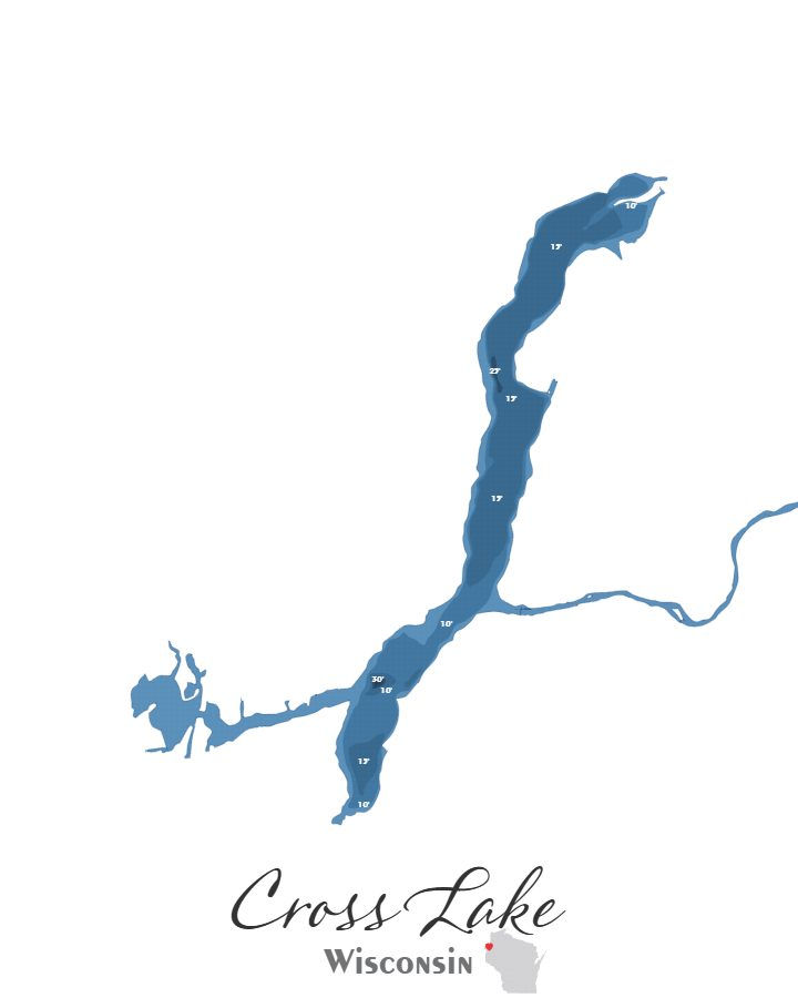
Cross Lake in Burnett County, Wisconsin covers approximately 1126.5 acres and reaches a maximum depth of 30.0 feet.
Cross Lake is available in two formats: a layered laser-cut bathymetric depth map and a canvas print, both utilizing my own original design sourced from actual sonar data collected from the lake.
The canvas print is available in three sizes — 5×7, 8×10, and 11×14 — and can be ordered with or without a black floating frame, making it a clean and versatile display option for homes, cabins, and offices.
The bathymetric laser-cut map is built from six precision-cut and engraved layers and comes standard with a black floating frame, ready for wall or shelf display. A backlit version is also available, which illuminates the depth layers from behind for a dramatic visual effect.
Each piece is made in-house from start to finish — from the original design through the laser cutting, staining, and final assembly — with help from my son Noah when needed.
*Depth marker placements shown in the preview may be refined in the final design to create the best overall appearance. Sundling Road watermarks may appear in preview images, but they will not be included on the final product.
First, choose your style:

Bathymetric

Canvas Print
Next, choose your size:
Next, choose your size:
Want it framed?

Choosing this option will add a floating canvas frame to your lake map. Your map will be mounted in the frame and ready to hang on your wall.
Want it backlit?

Choosing this option will add a USB powered LED light to your bathymetric depth map. LED lights are controlled via remote to be able to select both color and brightness.