
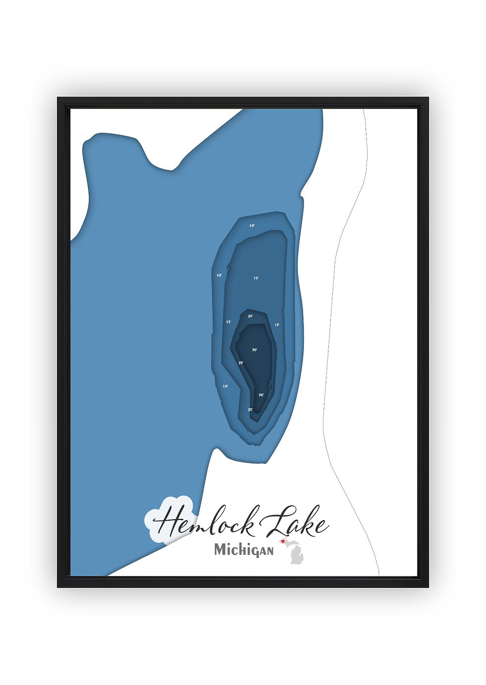
Hemlock Lake
Ontonagon County, Michigan

Hemlock Lake in Ontonagon County, Michigan covers approximately 12.4 acres and reaches a maximum depth of 30.0 feet.
Maps of Hemlock Lake are offered in two styles — a handcrafted laser-cut bathymetric map and a canvas print — each based on my own design drawn from actual sonar data gathered from the lake.
The canvas print is available in three sizes — 5×7, 8×10, and 11×14 — and can be ordered with or without a black floating frame, making it a clean and versatile display option for homes, cabins, and offices.
The bathymetric map arrives assembled with six precision-cut layers and mounted in a black floating frame. A backlit option is available for those who want a distinctive illuminated display version.
Each piece is made in-house from start to finish — from the original design through the laser cutting, staining, and final assembly — with help from my son Noah when needed.
*Product images are designed to closely represent the final piece. However, because each item is handmade and customized to the size selected, slight variations may occur in the final product. These may include adjustments to water placement, depth markers, labels, and other design elements to create the best overall appearance.
First, choose your style:

Bathymetric
Canvas Print
Next, choose your size:
Next, choose your size:
Want it framed?

Choosing this option will add a floating canvas frame to your lake map. Your map will be mounted in the frame and ready to hang on your wall.
Want it backlit?

Choosing this option will add a USB powered LED light to your bathymetric depth map. LED lights are controlled via remote to be able to select both color and brightness.