
McIntosh Lake
Presque Isle County, Michigan
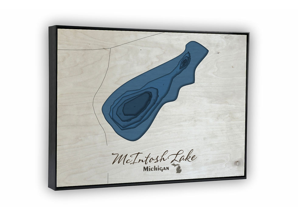
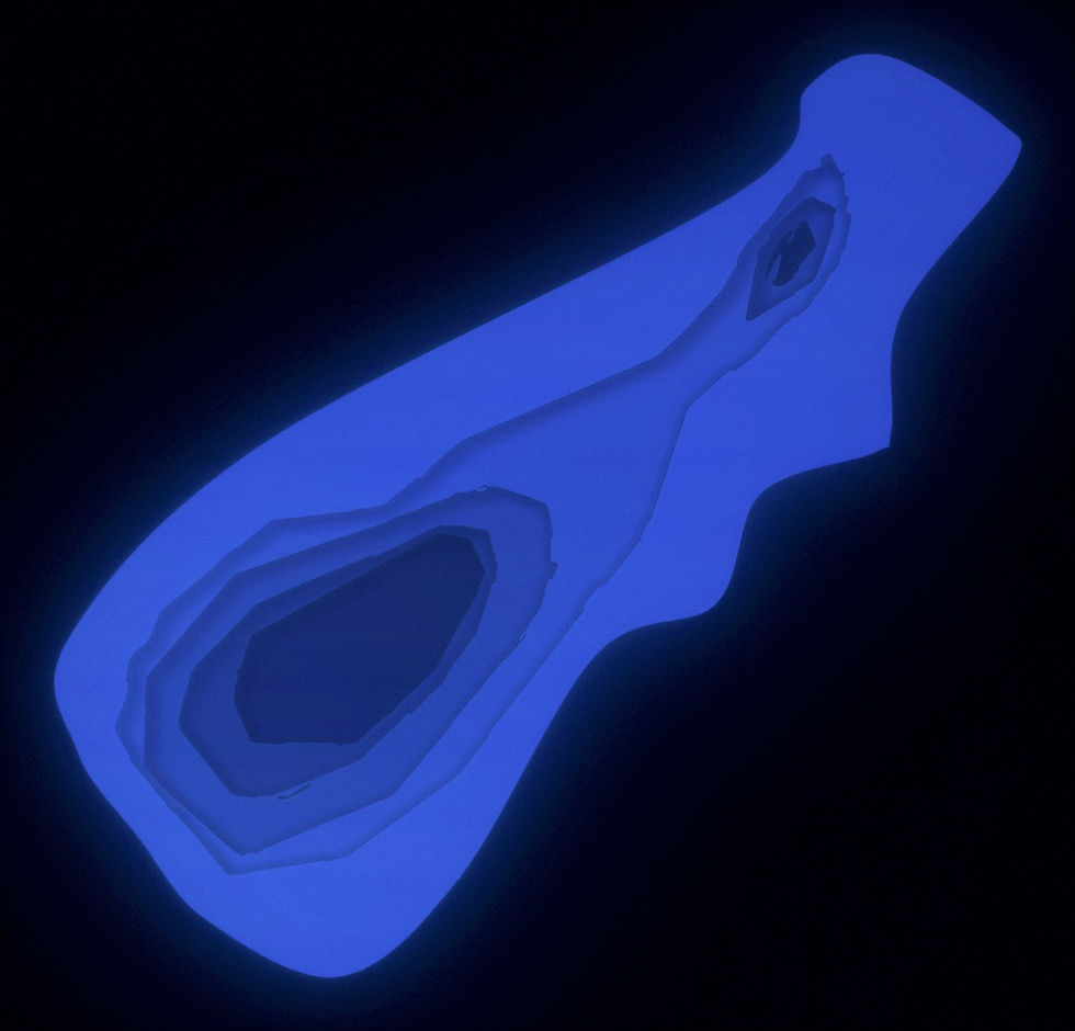
McIntosh Lake in Presque Isle County, Michigan covers approximately 10.4 acres and reaches a maximum depth of 21.0 feet.
Both the canvas print and the laser-cut bathymetric version of this McIntosh Lake map are built from the same original design, developed using real sonar-based depth data from the lake itself.
Available in 5×7, 8×10, and 11×14, the canvas print can be displayed on its own or paired with an optional black floating frame that gives it a polished and modern presentation.
The bathymetric laser-cut map is built from six precision-cut and engraved layers and comes standard with a black floating frame, ready for wall or shelf display. A backlit version is also available, which illuminates the depth layers from behind for a dramatic visual effect.
Every map — whether canvas or bathymetric — is personally designed and produced in-house. The laser cutting, assembly, and finishing are completed by hand, either by myself or with the help of my son Noah.
*Product images are designed to closely represent the final piece. However, because each item is handmade and customized to the size selected, slight variations may occur in the final product. These may include adjustments to water placement, depth markers, labels, and other design elements to create the best overall appearance.
First, choose your style:

Bathymetric

Canvas Print
Next, choose your size:
Next, choose your size:
Want it framed?

Choosing this option will add a floating canvas frame to your lake map. Your map will be mounted in the frame and ready to hang on your wall.
Want it backlit?
Choosing this option will add a USB powered LED light to your bathymetric depth map. LED lights are controlled via remote to be able to select both color and brightness.