
Mirror Lake
Washtenaw County, Michigan

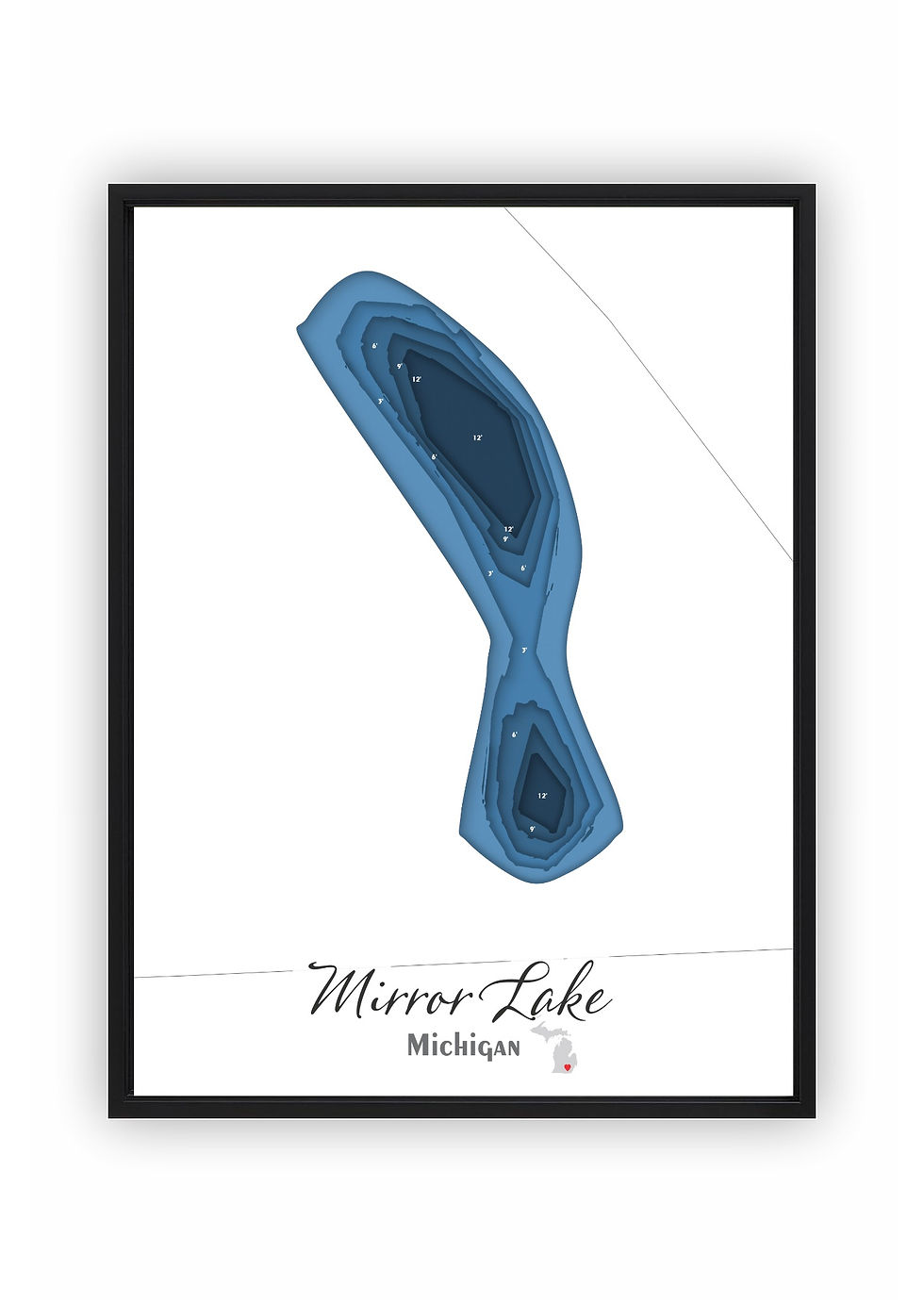
Mirror Lake in Washtenaw County, Michigan covers approximately 4.0 acres and reaches a maximum depth of 12.0 feet.
Whether you prefer a canvas print or a layered laser-cut bathymetric map, both versions of the Mirror Lake design use my own original artwork developed from real sonar depth readings taken from the lake.
Canvas prints are offered in 5×7, 8×10, and 11×14 sizes, with the option to add a black floating frame for a finished, gallery-ready look suitable for any wall display.
Laser-cut from six layered sections using real depth contour data, the bathymetric map arrives in a black floating frame. For those looking for something more striking, a backlit upgrade is available that lights the layers from behind.
Every map — whether canvas or bathymetric — is personally designed and produced in-house. The laser cutting, assembly, and finishing are completed by hand, either by myself or with the help of my son Noah.
*Product images are designed to closely represent the final piece. However, because each item is handmade and customized to the size selected, slight variations may occur in the final product. These may include adjustments to water placement, depth markers, labels, and other design elements to create the best overall appearance.
First, choose your style:

Bathymetric
Canvas Print
Next, choose your size:
Next, choose your size:
Want it framed?

Choosing this option will add a floating canvas frame to your lake map. Your map will be mounted in the frame and ready to hang on your wall.
Want it backlit?

Choosing this option will add a USB powered LED light to your bathymetric depth map. LED lights are controlled via remote to be able to select both color and brightness.