
Muskellunge Lake
Bayfield County, Wisconsin
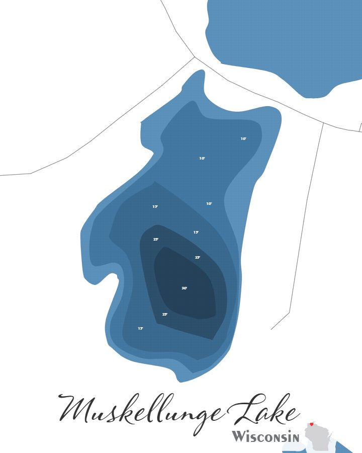
Muskellunge Lake in Bayfield County, Wisconsin covers approximately 43.4 acres and reaches a maximum depth of 30.0 feet.
Muskellunge Lake is available in two formats: a layered laser-cut bathymetric depth map and a canvas print, both utilizing my own original design sourced from actual sonar data collected from the lake.
Available in 5×7, 8×10, and 11×14, the canvas print can be displayed on its own or paired with an optional black floating frame that gives it a polished and modern presentation.
Laser-cut from six layered sections using real depth contour data, the bathymetric map arrives in a black floating frame. For those looking for something more striking, a backlit upgrade is available that lights the layers from behind.
Every map — whether canvas or bathymetric — is personally designed and produced in-house. The laser cutting, assembly, and finishing are completed by hand, either by myself or with the help of my son Noah.
*Depth marker placements shown in the preview may be refined in the final design to create the best overall appearance. Sundling Road watermarks may appear in preview images, but they will not be included on the final product.
First, choose your style:

Bathymetric

Canvas Print
Next, choose your size:
Next, choose your size:
Want it framed?

Choosing this option will add a floating canvas frame to your lake map. Your map will be mounted in the frame and ready to hang on your wall.
Want it backlit?

Choosing this option will add a USB powered LED light to your bathymetric depth map. LED lights are controlled via remote to be able to select both color and brightness.