
Odd Lake
Chippewa County, Wisconsin
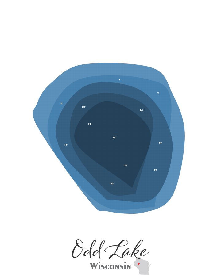
Odd Lake in Chippewa County, Wisconsin covers approximately 1.5 acres and reaches a maximum depth of 25.0 feet.
Maps of Odd Lake are offered in two styles — a handcrafted laser-cut bathymetric map and a canvas print — each based on my own design drawn from actual sonar data gathered from the lake.
Available in 5×7, 8×10, and 11×14, the canvas print can be displayed on its own or paired with an optional black floating frame that gives it a polished and modern presentation.
The bathymetric laser-cut map is built from six precision-cut and engraved layers and comes standard with a black floating frame, ready for wall or shelf display. A backlit version is also available, which illuminates the depth layers from behind for a dramatic visual effect.
From design through final assembly, every map is produced in my own shop. I handle the laser cutting, finishing, and construction personally, and my son Noah is often part of the process.
*Depth marker placements shown in the preview may be refined in the final design to create the best overall appearance. Sundling Road watermarks may appear in preview images, but they will not be included on the final product.
First, choose your style:

Bathymetric

Canvas Print
Next, choose your size:
Next, choose your size:
Want it framed?

Choosing this option will add a floating canvas frame to your lake map. Your map will be mounted in the frame and ready to hang on your wall.
Want it backlit?

Choosing this option will add a USB powered LED light to your bathymetric depth map. LED lights are controlled via remote to be able to select both color and brightness.